The model, constructed for about $15 million, was functional for less than five years.
The process of building the Bay Model began in the mid-1960s, a time of growing awareness that humanity’s booming population was impacting our environment.
The Air Pollution Control Act, authorized by Congress in 1955, was the first legislation designed to address the dangers that air pollution presented to public health. In 1960, the world ‘s population had reached 3 billion (It’s 7.6 billion today), and congress passed both the Federal Water Pollution Control Act, and the Wilderness Act, which was designed to protect “where man himself is a visitor who does not remain.” Silent Spring, Rachel Carson’s landmark book on environmentalism, was published in 1962, and the Clean Air Act was established in 1963.
Here along the shores of the Chesapeake, people were growing aware of the increasing amounts of pollutants flowing into the bay. Regional commercial fisheries were in an obvious decline, pollution was deemed a major factor, and for the first time, the safe recreational use of our waterways was in question.
In 1965, the same year the Water Quality Act and the Solid Waste Disposal Act were instituted, Maryland Congressman Rogers C.B. Morton (1914-1979), who lived in Talbot County on the Eastern Shore, launched a study mandated to “complete an investigation and study of water utilization and control of the Chesapeake Bay Basin.”
It would be eight years before construction on the hydraulic model would begin, by which point Morton was appointed Secretary of the Interior by President Nixon. During that time, much debate centered on whether the model was actually a smart idea.
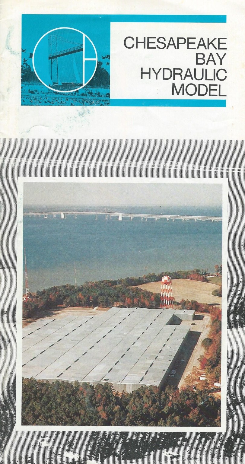
In 1967, MIT suggested that a numerical model would be cheaper and more effective than the physical models already built by the Army Corps of Engineers for the Mississippi River Delta and San Francisco Bay. Despite this advice, however, the Corps proceeded with plans to construct their physical model of the Chesapeake. Various locations around the bay were considered, but powerful political forces advocated that the site be constructed on Kent Island. The proposed project was being touted as a not only a scientific advancement, but also a tourist attraction.
")
")

Five years later funding for the Bay Model was granted by Congress.
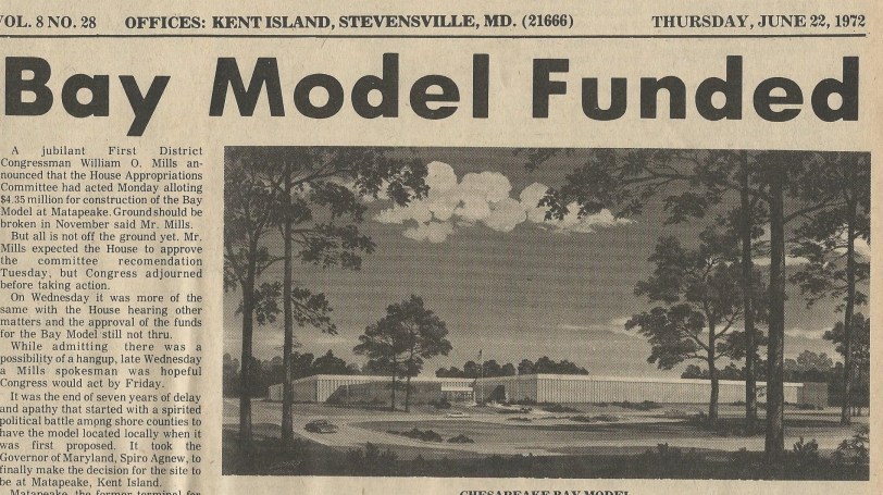
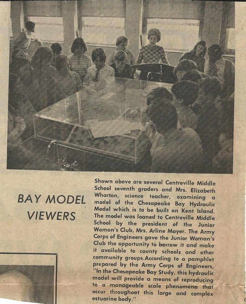
Ground was broken in June, 1973. By 1975, bathymetric readings of the bay were being taken in order to lay the models foundation inside the old Matapeake ferry terminal. In 1978, the facility opened to the public.
According to a 1998 report and exhibition organized by The Center for Land Use Interpretation, the Chesapeake Bay Hydraulic Model functioned in this manner:
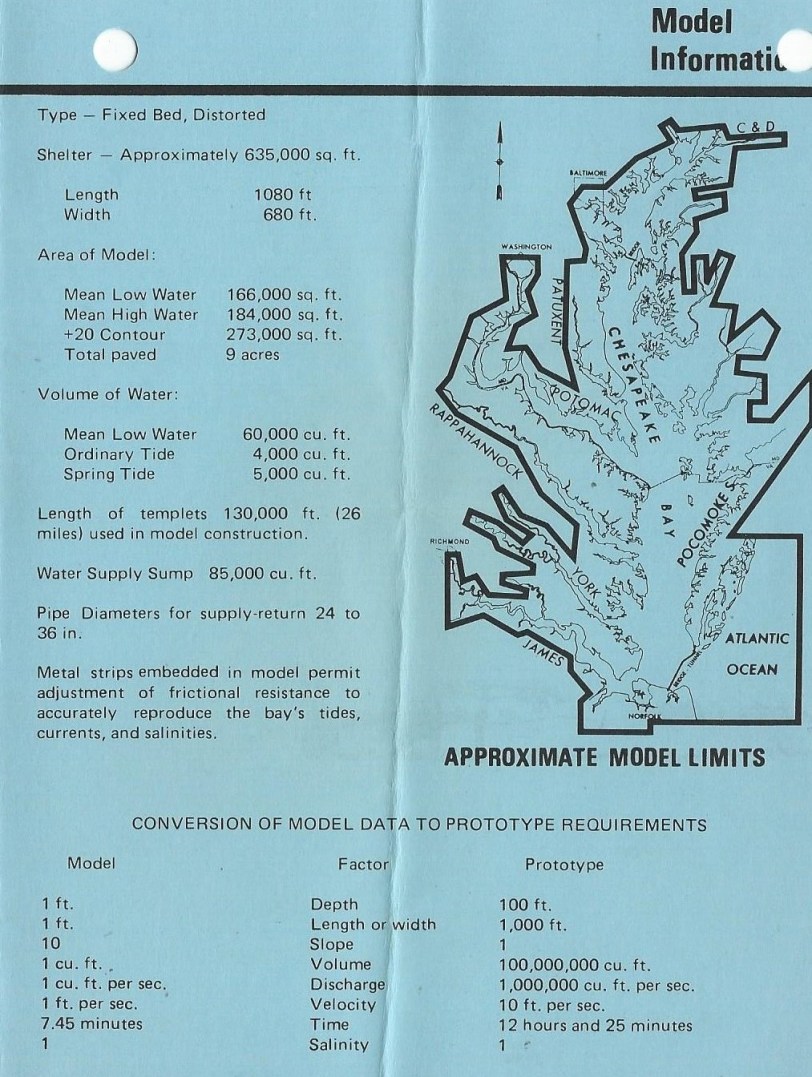
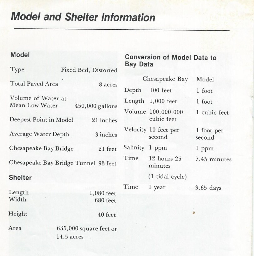
“Water entered the model at measured rates from inflow stations at the head of nine miniature rivers, and salt water, with exactly controlled salinity levels, flowed into a simulated Atlantic Ocean headbay, at tidal heights that could be adjusted on demand.
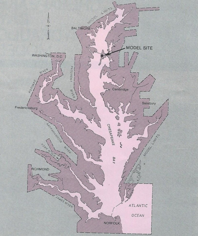
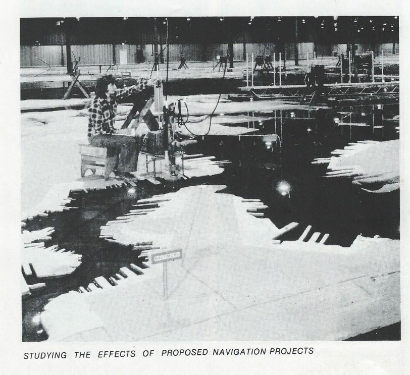
“That’s 4,400 square miles distilled, condensed through geometric ingenuity…to make the microcosm more complete, time was also scaled down; 15 years of real time on the bay could be simulated in just 19 days on the model. Control of the temporal, as well as the spatial dimension of the bay was of great utility to the researchers, because it allowed them to project the effects of various factors on bay health well into the future. To run just one test…took a team of 20 people, some of them hydraulic engineers, some computer analysts operating machines primitive by today’s standards that ran the model’s tidal generators and collected data on miles of magnetic tape.”


Unfortunately, by the time the model opened to the public, it was already obsolete. According to the CLUI, in the decades it took for the model to reach peak operational status, advances in computer-based mathematical models were coming into use, making the site little more than a “public works novelty,” an “anomalous, colossal misuse of public funds,” and “a titanic analog to the emerging digital age”.
Physically, the old warehouse where the model was located was shabby from the beginning. By the time the project was functional, “chunks of the warehouse ceiling that had been falling out all along became too numerous to remove, the cracks in the leaky concrete foundation too wide to patch. Problems such as the buckling of the model surface, due to insufficient expansion joints, shut the model down for repairs for months. Insulation sprayed onto the ceiling to help attenuate the temperature extremes in the windowless building (120 degrees F in the summer to below freezing in the winter), became saturated and began to fall onto the model.”
The Bay Model officially closed for good in February, 1983.
About 120,000 people are estimated to have visited while it was open.
The project sat abandoned for decades, and after several attempts by federal, state, and local governments to make use of the site, eventually the entire 60 acres were redesigned into a business park which now houses several successful commercial endeavors, and is part of the Cross Island Trail, a popular 6-mile recreational walking and bike route.
And today, though computer programs can do all the things the physical Bay Model could do and more, in a fraction of a fraction of the time, the virtual applications just don’t seem to have have the charm of that crumbling old concrete pad surrounded by a dilapidated metal superstructure.
I guess those were the days.
https://www.chesapeakebay.net/what/programs/modeling – Chesapeake Bay Program Computer Modeling


Click to access chesapeake_bay_hydraulic_model.pdf
BOOKS MAKE GREAT GIFTS!
BRENT LEWIS’ REMEMBERING KENT ISLAND: STORIES FROM THE CHESAPEAKE, A HISTORY OF THE KENT ISLAND FIRE DEPARTMENT, AND THE NOVEL, BLOODY POINT 1976, ARE AVAILABLE ONLINE AND AT VARIOUS LOCAL RETAIL OUTLETS.


